Tischer Creek Watershed
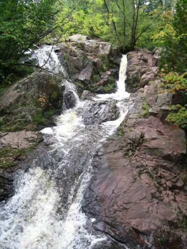
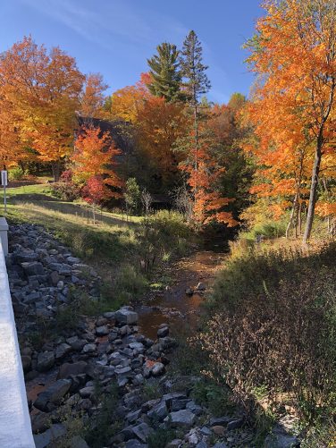
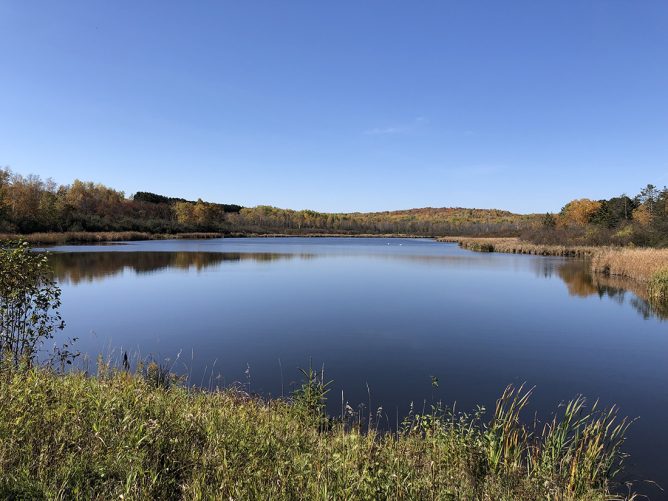
Known for its beautiful waterfalls, hiking trails, high quality brook trout fishing, and valued public access, Tischer Creek is increasingly impacted by “urban stream syndrome”; the effects of urbanization. The expansion of impervious surfaces, presence of stream impoundments, and channel modifications have altered the stream’s natural hydrology. The changes have led to elevated water temperatures and degraded habitat conditions, making the stream less suitable for cold water fish species such as brook trout. Additionally, the Minnesota Pollution Control Agency (MPCA) has listed Tischer Creek as impaired for E. coli, making it unsafe for human recreation.
The Minnesota Department of Natural Resources (MNDNR), Division of Fish and Wildlife contracted with GEI to gather data from agencies, researchers, and organizations that have studied the Tischer Creek watershed over several decades.
The goal? Develop a comprehensive “Roadmap to Resilience” – a strategic framework designed not just to address isolated issues, but to guide the restoration, protection, and long-term resilience of the watershed. Rather than simply addressing individual problems in the creek, the MNDNR envisioned a big picture, system-based approach that would allow them to holistically evaluate, prioritize, and implement actions with lasting impact. Achieving this vision requires the integration of all available research, monitoring efforts, and planning documents related to the creek and its stressors. It also requires the willingness of natural resource management partners to invest their time and resources to accomplish specific roadmap objectives.
To help the MNDNR achieve its goal, GEI’s Duluth-based team met with more than 50 partners and agencies who had researched watershed issues. Drawing on decades of data, research, and institutional knowledge, partners and stakeholders worked together to develop a comprehensive and holistic plan. While the MNDNR expected to receive a standard paper report back, GEI recognized the need for a dynamic, accessible, and actionable solution.
To that end, GEI designed an ArcGIS Hub Site, a cloud platform that would creatively illustrate and prioritize projects that would increase the watershed’s resilience. Working with the City of Duluth and project partners, the team defined watershed stressors and identified objectives/projects to address the stressors. Through additional workshops and coordination meetings with partners and stakeholders, GEI helped assign measurable indicators to each project, which helped prioritize projects and demonstrated progress towards achieving overall roadmap goals.
In the end, what the MNDNR and partners thought would only be a handful of projects culminated in 89 specific projects that would make up Tischer Creek’s Roadmap to Resilience.
The GEI team’s two-year effort to develop the custom watershed planning framework culminated in the Hub Site, which provides community engagement and transparency. The Hub Site, which lives on the City of Duluth’s website, shows the progress of the projects and how they are integrated into the goal of enhancing the resilience of Tischer Creek watershed to the negative impacts of climate change and urban development.
The Tischer Creek Roadmap to Resilience is the first Roadmap completed for a watershed in the State of Minnesota. The MNDNR is using the roadmap as a template for other small watersheds that are part of the greater Lake Superior Watershed.
GEI was recently awarded the Keene Creek Roadmap to Resilience project and will develop a similar Hub Site that will also be used for data collection and community input.
Key Facts