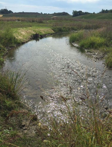
Brent Run
GEI’s integrated team of ecologists and engineers were hired to assess, survey, design, and obtain permits/approvals from state and federal agencies for relocation of 4,000 linear feet of stream, 10 acres of wetland impact, relocation of threatened freshwater mussel species, and creation of over 26 acres of mitigation wetland to accommodate the expansion of the Brent Run Landfill in Montrose, Michigan. GEI has also been charged with monitoring the long-term ecology and geomorphology and helping to maintain the planted landscape close to targets since construction was completed.
This project is the largest stream relocation project that has ever been permitted by the State of Michigan. GEI began the project with a natural resource assessment of approximately 300 acres of land and nearly two miles of stream, which required extensive coordination between state and federal agencies. Wetlands, floodplains, and stream resources were delineated and assessed, including bat trees, endangered species, macroinvertebrates, mussels, fish, stream bed sediment, hydrology, hydraulics, and sediment transport. These collective resources and their environmental needs were considered and built into the final project design to meet the client’s schedule and budgetary needs.
Key Challenges
The project demanded extensive meeting time and correspondence with state and federal agencies. Extensive communication greatly contributed to securing acceptance of the “Feasible and Prudent Alternative Analysis” for the project by the federal and state agencies before the permit application was submitted. This was the first time in Michigan history where approval was given before a complete application was submitted.
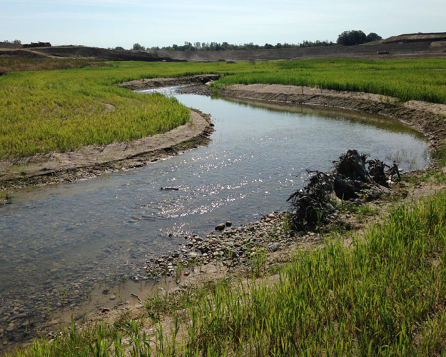
GEI submitted the application for construction of the new stream channel and approximately 26 acres of wetland for compensatory mitigation for the permitting of stream and wetland impacts associated with the expansion of the landfill. The project design minimized and mitigated for wetland impacts but also improved existing stream resources. Because this was to be the largest stream relocation in MDEQ history, the MDEQ conditioned the permit with numerous assessments not typically required, including: hydrologic monitoring and modeling, sediment transport monitoring and modeling, and application of natural channel design principles including the assessment of the fluvial geomorphology, hydrology and sediment transport properties of a reference reach.
This project has begun to collect post-construction data that suggests the design approach here – using natural channel design to establish some wide bounds for the channel, while the modeling is done in a probabilistic fashion and used to optimize design for self-maintaining pool-riffles – is performing mostly per projections. GEI’s modeling work suggested a channel narrower than any of the Michigan regional curve data points. At the time the project team set the design at the lower limit of the regional curve, worried that suggesting design parameters outside of the already wide-error bounds would take longer to get a permit. Indeed, while the two-year old channel width is on average roughly the same as installed, there are definitely reaches where sediment deposition is narrowing channel width.
In spite of the MDEQ’s conditional permit and extra requirements, GEI was able to keep to the client’s critical project schedule, even incorporating a re-design following the necessary permitting tasks. GEI was cognizant of the client’s timeline, and was challenged to adhere to it even when unexpected factors came into play. This was the case when the project scope had to be accelerated by an entire year due to complications with landfill cell construction. Because of the project team’s resourcefulness and diligence in planning and solving the design and permitting challenges, the client was able to keep the landfill in operation the entire length of the project despite complicating factors outside of the client’s control, which minimized losses from landfill operation and construction costs.
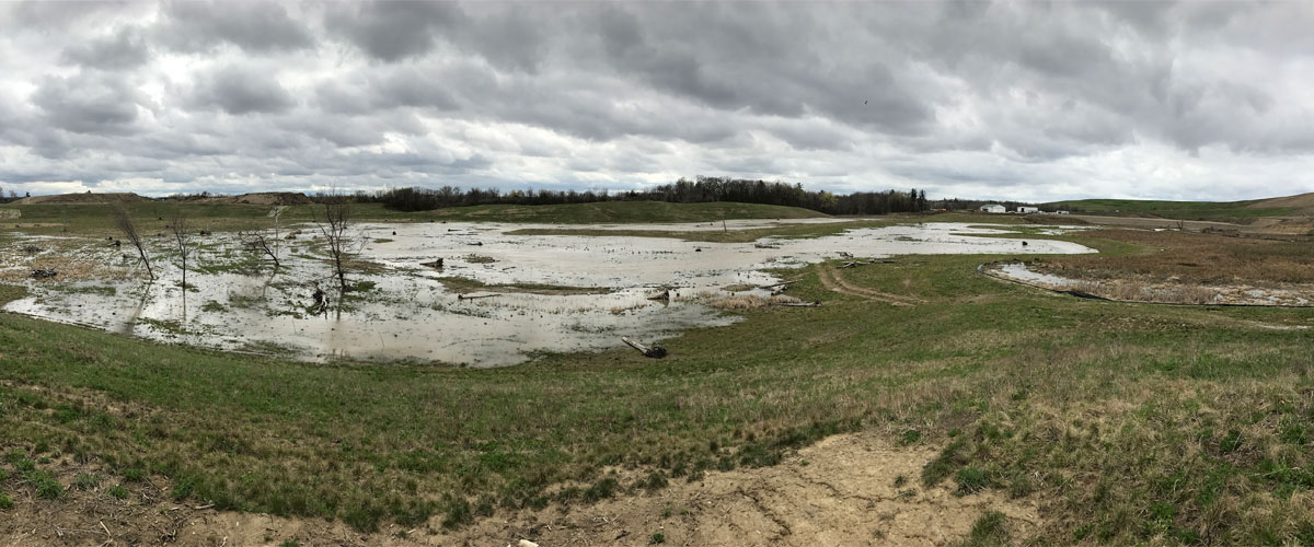
The project team was a part of another cost-saving solution for the client in the excavation of materials from the site. Due to space constraints and property ownership concerns, construction of the new stream and floodplain required excavation of approximately 1.6 million cubic yards of material. Rather than hauling this material offsite, it was beneficially reused in building the walls of the new landfill cell, which saved the client nearly 90% of potential costs because the material did not require off site transport, and new material was not required for the new landfill cell walls
GEI oversaw floodplain and channel grading of over 1.8 million cubic yards of soil while installing riffle habitat structures and relocating mussels, including endangered species, from the abandoned stream channel. GEI was also responsible for the installation of 28 acres of native wetland seed, erosion control measures, and 15,000 trees.
As predicted, the relocated stream is performing well, and the project team has received praise from the state and federal agencies involved. State agencies have begun using the site as an exemplification of a stream restoration project that appears to be meeting expectations. GEI is currently working with the client on a ten-year monitoring and maintenance period for the new floodplain and stream.