Gulf Coast Refinery 3D LNAPL Conceptual Model
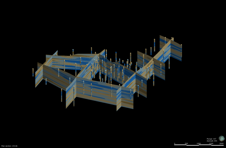
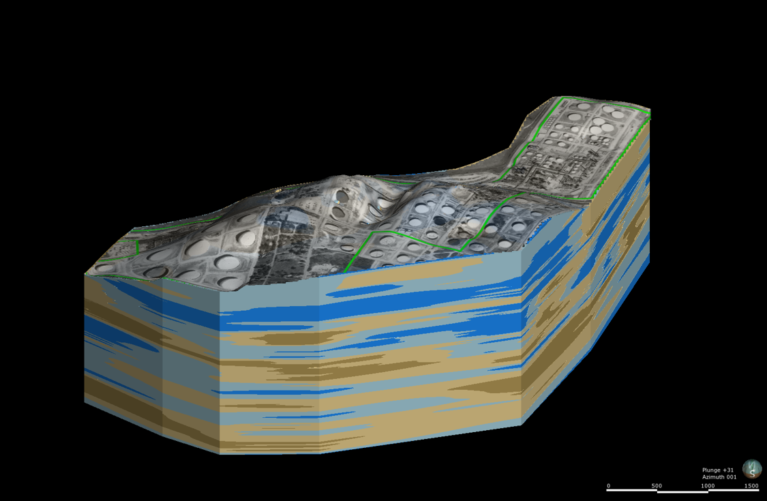
GEI prepared a comprehensive 3D LNAPL Conceptual Site Model (LCSM) along with extensive analytics and statistical analyses for an active refinery. The model and associated work was utilized to evaluate the performance of an ongoing remedy as well as to illustrate the results of the evaluation to the site regulator. It continues to be used as a live model for evaluation of new projects or potential issues as site conditions change.
Key Challenges
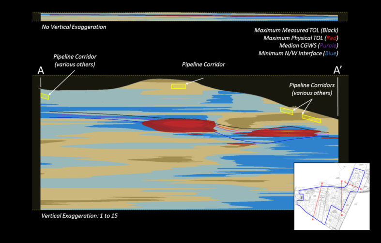
The USEPA approached this confidential client with concerns over suspected contamination by pipelines. The client anticipated several million dollars’ worth of work to perform an investigation to determine what was happening. The site has a complex geology and hydrogeology as well as multiple historic releases on-site that are commingled with off-site sources. A new approach was needed to incorporate decades of data of various types and sources into a single tool for an effective evaluation. The GEI Team built a full 3D LNAPL Conceptual Site Model (LCSM) and was ultimately able to determine that the contamination was well below any of the pipelines, establishing that they couldn’t be the source of the suspected contamination.
The results gained by the LNAPL model not only created significant direct cost savings for the client, but also limited potential liability and negative public exposure. Images, cross-sections, and movies constructed from the model were incorporated into a presentation and meeting with the site regulator. GEI and the client were successful in demonstrating the success of the current remedy to the regulating agency.
The USEPA was so impressed with this unique 3D study and its results that they asked the client to share the results with other local refinery companies in order to try to convince them to do the same level of work. GEI’s 3D LNAPL model provided a vehicle for the client to set the stage for proving to regulators that the client can turn off many remediation wells at the site. The client continues to support incorporating additional site data into the model as it is collected and maintaining it as a live tool to use for ongoing and future projects.
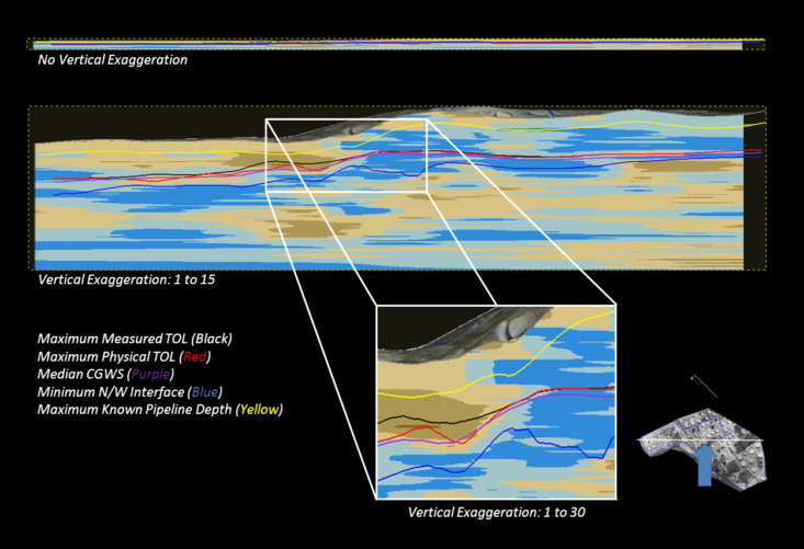
The model provided a visual representation of the complex geology and hydrogeology of the site, which leads to exaggerated thicknesses of LNAPL in wells that are not indicative of the recoverability of the LNAPL. The model was then utilized to evaluate where and why the exaggerated thicknesses occurred as a critical component of a demonstration that the existing remedy had sufficient coverage, both laterally and vertically, to achieve the remedy goals for the site.