Horseshoe Bend
The Sacramento–San Joaquin Delta is the largest estuary west of the Mississippi River and a critical hub for water supply, flood management, and ecosystem health. Located near San Francisco Bay, the Delta provides water to more than 24 million Californians while supporting sensitive and declining fish and wildlife species. Maintaining flood protection infrastructure in this setting presents a complex challenge: protecting lives, property, and water supply reliability while preserving—and where possible enhancing—habitat within a dynamic tidal system. Multi-objective projects are increasingly encouraged in the Delta, but balancing flood risk reduction, ecosystem protection, and climate adaptability requires flexibility, coordination, and innovative delivery approaches.
The Horseshoe Bend project (Project) on Bethel Island is a prime example of a collaborative, multi-objective approach to levee rehabilitation. The project brought together private landowners, local government, and state and federal agencies to efficiently advance financing, design, and construction. GEI served as the District Engineer and led planning, design, and implementation, including identifying funding sources, preparing grant applications, and assembling an interdisciplinary team of engineers and scientists. In parallel with levee rehabilitation, the project integrated waterside habitat enhancements designed to support fish and wildlife while maintaining flood protection performance.
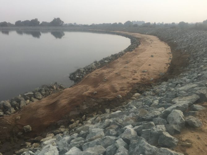
The habitat features were designed to be fish-friendly and responsive to the Delta’s tidal dynamics. An approximately 18-foot-wide waterside bench was constructed and divided into two planting zones: an 8-foot-wide riparian zone set one foot above mean higher high water and a 10-foot-wide intertidal zone sloping down to mean low water. The design relies on daily tidal inundation of the intertidal zone and subsurface soil wetting in the riparian zone to sustain vegetation without active irrigation. Riparian and tidal wetland vegetation provides rearing habitat, cover, and refuge for fish and other aquatic organisms, as well as spawning habitat for Delta smelt and other species, while contributing organic matter that supports invertebrates and the broader aquatic food web.
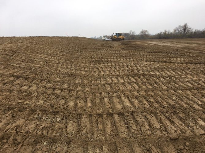
The Project resulted in a resilient, multi-benefit solution that addressed long-standing levee deficiencies while advancing ecosystem and water quality objectives. The project rehabilitated approximately one mile of existing levee surrounding Bethel Island, correcting deficiencies related to seepage, scour, slope instability, and potentially liquefiable foundation materials.
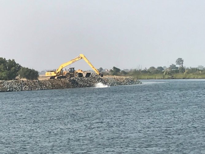
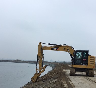
Key flood risk reduction outcomes included raising the levee crest, reshaping the levee prism, installing approximately 2,000 linear feet of undrained and drained stability berms, and armoring the waterside slope and toe with riprap to arrest ongoing scour in the Horseshoe Bend reach. These improvements strengthened a critical western Delta island that plays an essential role in preventing tidal saltwater intrusion and protecting regional water quality.
GEI delivered the project as District Engineer for the Bethel Island Municipal Improvement District, providing field investigations, engineering analysis, design plans and specifications, cost estimating, permitting support, and construction management through completion. The project was delivered between 2015 and 2018 with a final construction value of approximately $5.2 million, following extensive coordination with local, state, and federal stakeholders.
Key Challenges
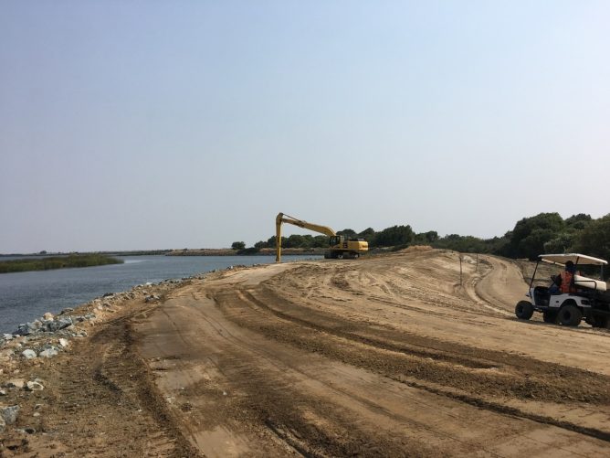
The project set the levee back to make wide crown to accommodate emergency services while it cut a portion of the levee on the waterside to create fish friendly habitat. The levees of bethel Island are mostly built on organic peat soils on top of layers of sand and require various methods of seepage control to maintain integrity. The project team decided to install blanket drains and collection system to capture seepage.
Among the challenges was protecting the newly created bench from erosion caused by tidal action and wind-wave and boat wake energy. The solution was two-fold: 1. natural fiber erosion blanket was installed on the bare soil on the bench, and 2. a wave break and groins approximately 1.5- to 3-feet in height and 2- to 4-feet wide were constructed with riprap. The top of the wave break was set at mean high water elevation and consisted of alternating 50-foot segments separated by 5-foot-wide openings to allow unobstructed access to the bench for fish. The perpendicular groins were spaced approximately 200 feet apart, creating breaks between planting areas to capture sediment.
FINAL AND SUCCESSFUL OUTCOME
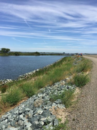
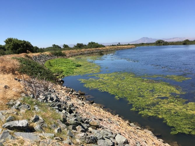
In addition to a new and improved levee, the project delivered a new waterside habitat which is now in its third growing season and the bench is dense with vegetation and already providing valuable habitat for insects, birds, wildlife, and fish. The key to a successful design was accurately calculating the range of tidal water surface elevations, setting bench elevations to create target habitats, and maintaining elevation controls during construction. This set up the site to be planted with the appropriate species for the desired habitats without the need for supplemental irrigation during site establishment. The key to the overall success of the Horseshoe Bend Project was the integration of the engineering and ecological design teams and an openness from State agencies to creative design solutions.