Thought Leadership
Navigating the Murky Waters: A Guide to Wetland Delineations
February 2, 2026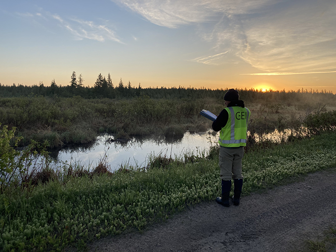
By Mari Olson – Wetland Ecologist
Before we dive into the topic of wetland delineation and why you might need one, let’s first understand what a wetland is. What comes to mind when you hear the term “wetland”? Most people conjure images of a swamp, marsh, or bog. However, there are numerous types of wetlands and contrary to popular belief, wetlands don’t have to be wet all the time. Many wetlands can be farmed, mowed for hay, maintained as lawns, or used for other purposes.
Simply, a wetland is an area of land that remains inundated or saturated by surface or groundwater at a frequency and duration sufficient to support plant species that are tolerant of prolonged inundation or soil saturation. In these areas, the presence of water is the primary factor controlling the plant and animal communities living in wetlands.
Wetlands provide a variety of ecosystem services which include water purification, flood control, recreation, and habitats for numerous wildlife species. And that is why wetlands are protected by federal, state, and local regulations. Because wetlands are protected, if your project involves impacts to a wetland in any way (i.e., build a new road or a new development project), then you’ll need to perform a wetland delineation first.
What is a wetland delineation?
You can think of a wetland delineation like a property survey, but instead of mapping buildings and lot lines, it maps features that may be subject to environmental regulations. Wetland delineations are often one of the first steps in understanding what can (and can’t) be done on a piece of land before a project moves forward. They help identify potential environmental constraints early in the planning process and support more informed project decisions.
A wetland delineation is a process of identifying the boundaries and characteristics of a wetland area in accordance with the standards set by the U.S. Army Corps of Engineers (USACE) and the Environmental Protection Agency (EPA). They are performed to determine if a site is subject to regulatory protection under the Clean Water Act, which aims to safeguard the nation’s waters and wetlands. Delineated wetlands may be subject to additional state and local regulations depending on your project’s location.
A wetland delineation typically involves four main steps:
- Preliminary assessment: This involves reviewing existing data sources such as topographic maps, aerial photographs, national and state wetland inventory maps, and soil surveys to identify potential wetland areas on the site.
- Field Investigation: This phase requires boots on the ground to confirm whether the suspected wetland areas identified during the preliminary assessment have the three necessary wetland parameters to be considered a wetland. The required parameters are hydrology or the ability of an area to hold water, the presence of wetland vegetation, and hydric soil characteristics. These wetland parameters are evaluated using a series of standard methods and technical guidelines established by the USACE and EPA.
- Delineation Report: This document summarizes the methodology and results of the field investigation and includes scaled maps that depict the wetland boundaries and types of wetlands present as well as the location of all data points and the area of investigation for the delineation project.
- Agency Concurrence: This phase requires regulatory agencies to confirm that the wetland boundaries identified in the wetland delineation report are accurate and that proper delineation procedures were utilized during the field investigation and properly documented in the report. The USACE issues federal wetland delineation concurrence. In addition, state agencies and local counties and municipalities with wetland regulations will also issue wetland delineation concurrence. Sometimes, a wetland delineator will complete an on-site visit with regulators as part of the concurrence process.
Why is a wetland delineation important?
Wetland delineations help project teams avoid surprises by clearly documenting where wetlands occur on a site before construction or design is finalized. Having this information early can reduce delays, redesigns, and uncertainty during later project phases. Delineation reports are commonly used by developers, engineers, planners, and landowners to support communication with regulatory agencies and to guide site layout, infrastructure placement, and construction planning.
Beyond development projects, wetland delineations also support restoration and conservation work. They can be used to establish baseline site conditions, inform restoration design, and support long-term monitoring and adaptive management efforts.
Who can perform wetland delineations?
Wetland delineations must be conducted by trained environmental professionals with the knowledge and experience needed to apply regulatory methods accurately. These professionals often include ecologists, biologists, botanists, or soil scientists who specialize in wetland identification and field investigations. Because wetland delineations involve technical fieldwork and regulatory standards, experience with local ecology, soils, hydrology, and plant communities is essential.
In many states, wetland professionals also hold specialized certifications or credentials that reflect advanced training in wetland science and delineation methods.
The bottom line
A wetland delineation is an important early step in understanding environmental conditions on a site. It provides practical information that supports project planning, regulatory coordination, and responsible land use. By documenting where wetlands occur and how they function, wetland delineations help project teams make informed decisions while balancing development needs with environmental considerations.
Interested in learning more?
Mari Olson is a wetland ecologist with GEI Consultants, where she supports clients with wetland delineations, permitting, and threatened and endangered species projects across the Midwest.